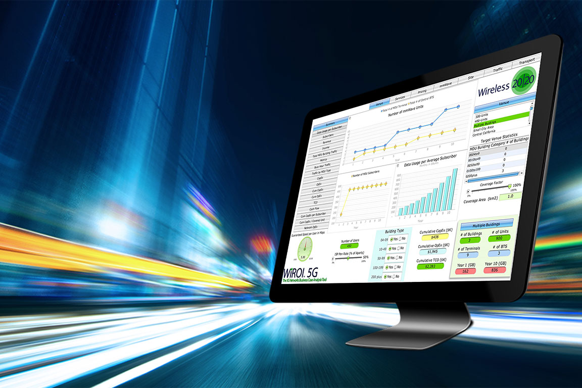
Wireless 20/20 has developed a new WiROI™ db Geospatial SaaS Platform to help operators select the best places to deploy fiber and wireless broadband networks and to support investors making Broadband Infrastructure investment decisions.

WiROI™ db 2.0 combines the latest FCC 477 dataset with an extensive US address database in an easy-to-use software package, giving clients the ability to identify, search, filter, sort, connect locations and extract maps and data for use in grant applications.
Created by the Software 20/20 development team, the WiROI db Geospatial SaaS Platform leverages an SQL database containing a complete set of the FCC 477 dataset, highly accurate location data, and the US Census Bureau GIS shapefiles in an easy to use “Excel-like” interface.
The WiROI™ db also includes the US FCC Tower database and Zoning information, which simplifies and automates the Fiber and Fixed-Wireless investment decision-making process.
The new tools and consulting services help clients identify unserved areas, calculate the cost to deploy fiber and broadband wireless networks, and quickly perform ROI analyses on thousands of clusters and millions of locations using AI and big data analytics.
The Federal Government has allocated $65 billion in funding for the “Broadband Equity, Access, and Deployment” (BEAD) program. About $45 billion will flow through the NTIA for broadband infrastructure projects around the country. The WiROI db is designed to help bidders analyze the ROI of deploying fiber and wireless networks and prepare bid packages to qualify for subsidy grants.
WiROI™ db 2.0 enables operators to identify uncabled dwellings in targeted expansion areas within or around the broadband provider’s current footprint using highly accurate location data, AI algorithms, and mapping services. Several broadband operator clients already rely on the Wireless 20/20 WiROI™ db 2.0 broadband database and mapping tools to identify the best places to build networks and prepare grant applications. WiROI™ db 2.0 SaaS platform and consulting services include:
- Access to the WiROI db SQL database
- FCC 477 and FCC tower data
- US Census Bureau data
- US geolocation data
- FCC RDOF and CAFII data
- Uncabled dwelling identification algorithms
- Grid and cluster analysis
- Optimized fiber path calculations
- Polygon and Census Block level mapping
- Aerial/underground fiber determination
- ROI Analysis
Wireless 20/20 offers solutions for service providers that optimize network evolution planning to automate, simplify, and streamline broadband network coverage expansion. Once the targeted areas are determined, the service identifies the available technology options, cost tradeoffs, and the extent of subsidies needed for a positive ROI.
The resulting data feeds into WiROI™ business case analysis and network planning tools to help them make investment decisions. By providing these comprehensive business case analysis and mapping tools, Wireless 20/20’s supports operators prepare grant applications and prioritizing their network buildouts.
WiROI™ db 2.0 helps answer the following key questions:
- Where are the best places to deploy fiber networks?
- Where are the Uncabled Dwellings?
- Within a certain county
- Without 10,20,30,40 and 50 miles of my footprint
- In any Census Block or Group
- In any polygon area
- How much fiber is needed to cover a specific area?
- How many households will a network pass?
- What is the Cost for Fiber Deployment, and what is the ROI?
- Which are the TOP 100 clusters out of Thousands?
To request information on the WiROI™ db Geospatial SaaS Platform, CLICK HERE.
WiROI™ db 2.0 Broadband Database
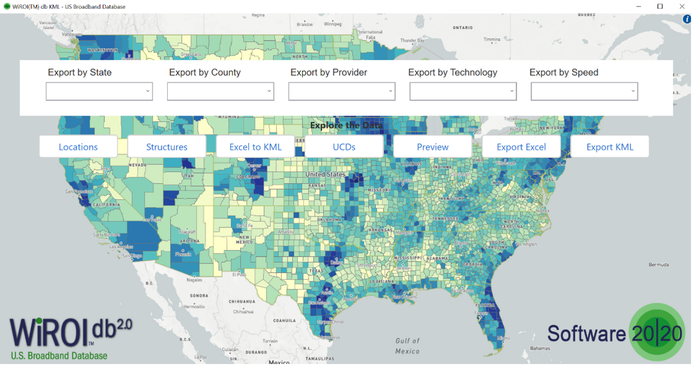
WiROI™ db 2.0 Broadband Database
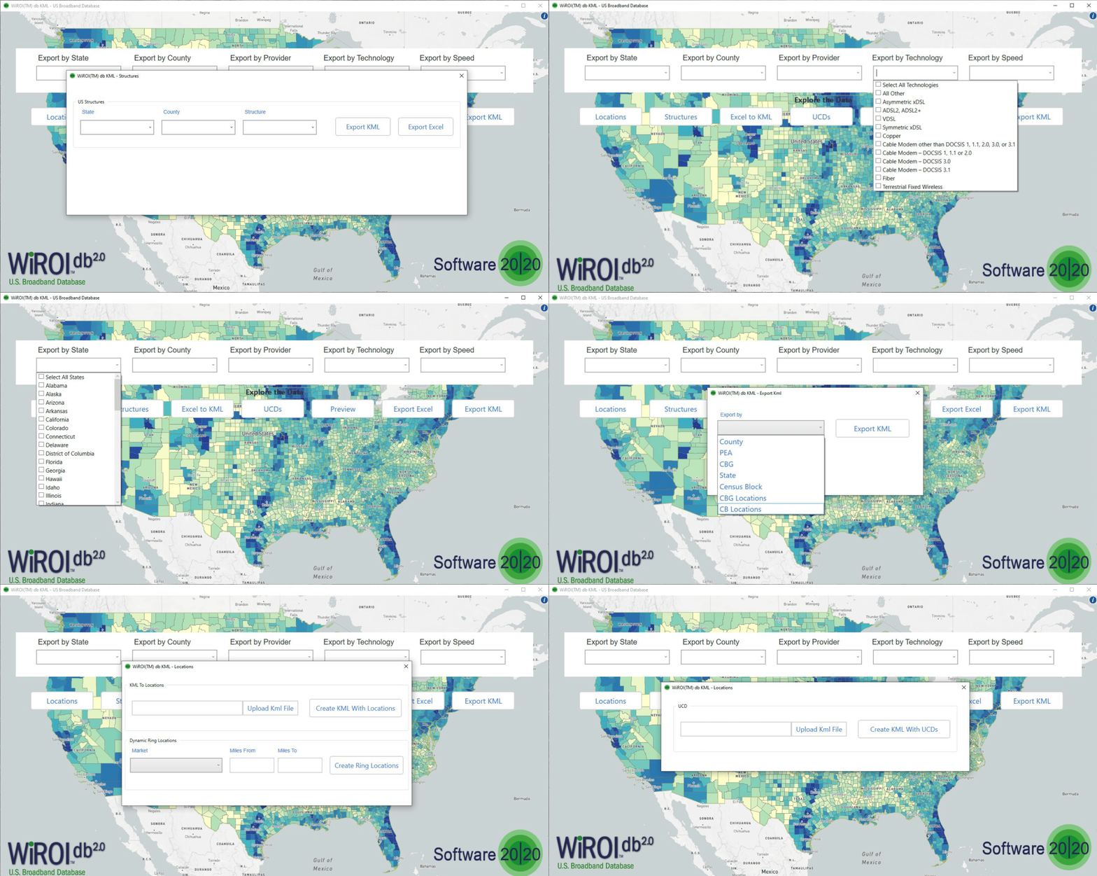
WiROI™ GEO Mapping Algorithms and Plug-Ins
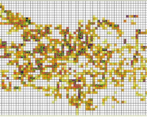

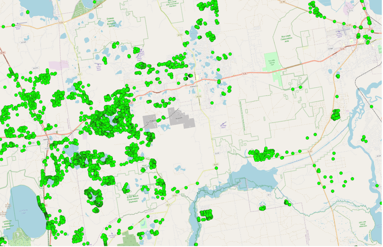
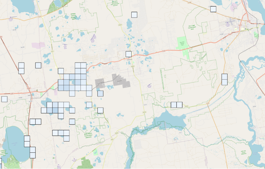
WiROI™ db Uncabled Dwelling (UCD) Identification
- Identify uncabled dwellings and pinpoint which clusters are likely candidates for fiber deployment and develop cluster analysis
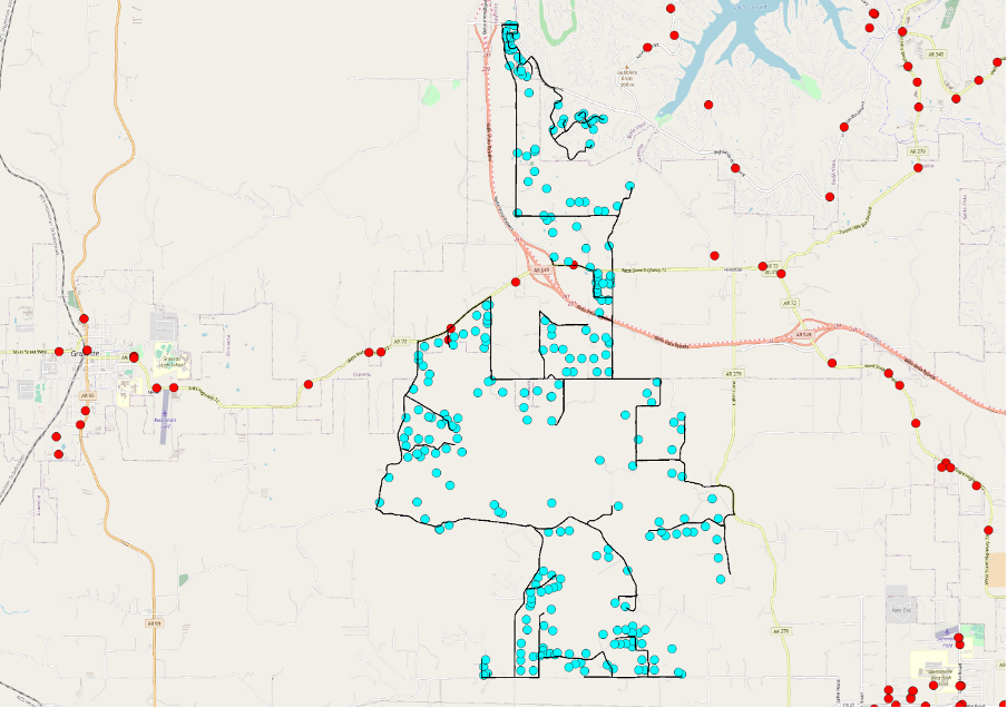
WiROI™ db Optimal Fiber Mapping Steiner Algorithm
- Automatically run fiber miles estimation algorithms to connect a set of UCDs
- Calculates the optimum Fiber miles and Exports Excel and KML maps of Road Segments
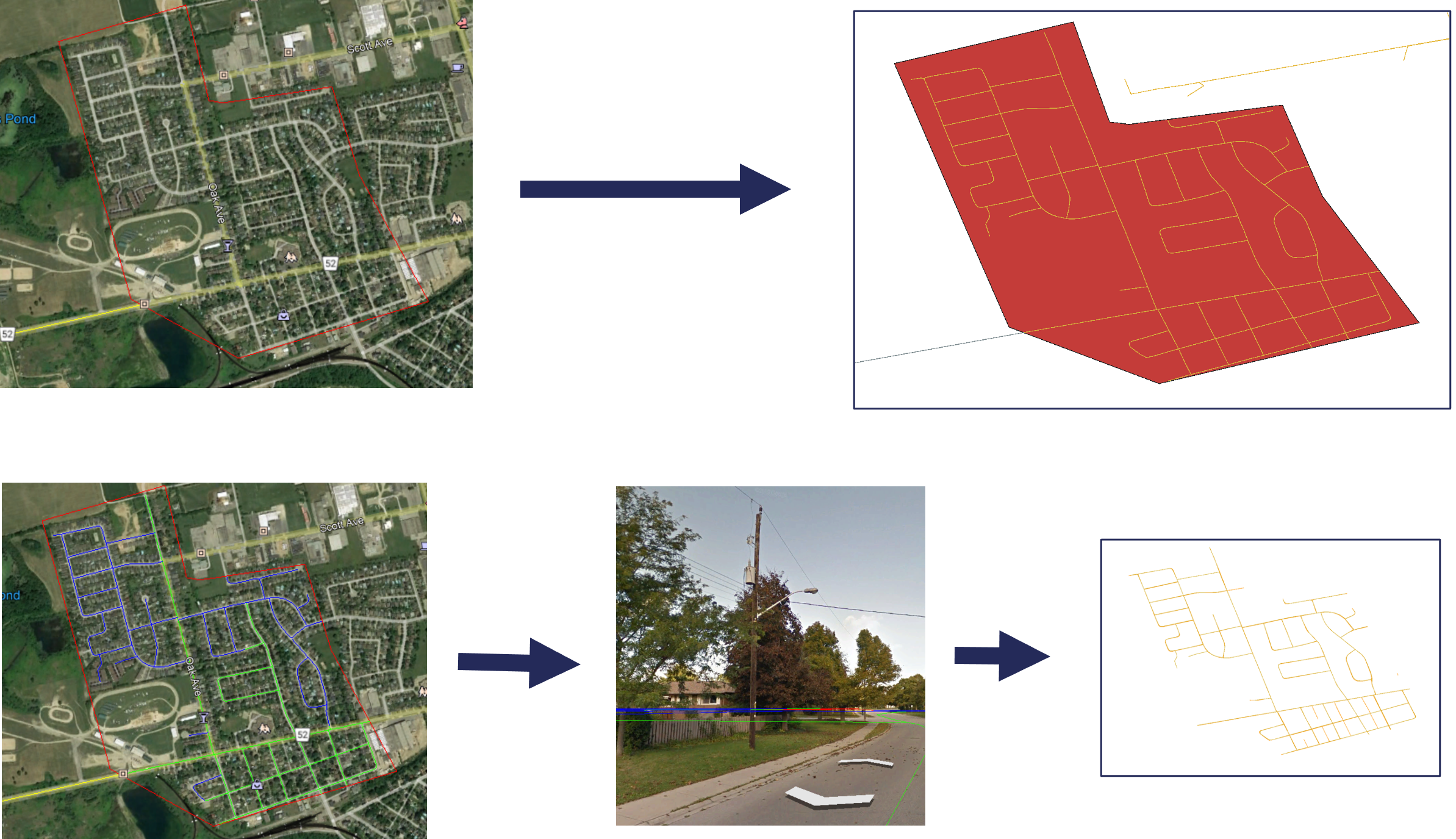
WiROI™ db Aerial vs. Underground Determination Algorithms for Precise Cost Estimation
- Cost to build fiber varies great depending Aerial vs. Underground cabling
- Determine whether road segments are Aerial vs. Underground
- Our Manual process is 99% accurate but takes time
- Our AI algorithms are 80% accurate and can analyze 1,000s of miles quickly
To arrange a demonstration or to request information on the WiROI™ db Geospatial SaaS Platform, CLICK HERE.

